Advanced Technologies in Avalanche Monitoring and Prevention

Advanced Technologies in Avalanche Monitoring and Prevention

In the realm of natural disasters, few are as violently unpredictable and destructively powerful as avalanches. These rapid flows of snow down a slope can occur in any mountainous area, posing a serious risk to human life and infrastructure. However, advances in technology have brought about a new era in avalanche monitoring and prevention, providing critical insights and tools that help mitigate these risks.

The Importance of Avalanche Monitoring

Avalanches are primarily triggered by a combination of factors including snowfall, wind, temperature, terrain, and human activity. The traditional methods of predicting and monitoring avalanches relied heavily on manual observations and experience-based assessments. While these methods have been invaluable, the advent of technological solutions has transformed the landscape of avalanche safety.

Technologies at the Forefront

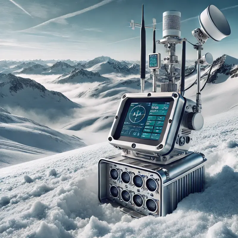
One of the most significant advancements in this field is the development of automated avalanche detection systems. These systems utilize a variety of sensors to continuously monitor conditions in avalanche-prone areas. Ground-based radar systems, for instance, can detect minute changes in the snowpack, identifying potentially unstable conditions before an avalanche is triggered.

In addition to ground radar, satellite imagery and aerial drones provide comprehensive data on snow cover, density, and moisture content. Drones, equipped with thermal imaging cameras and GPS technology, are particularly useful for surveying large and inaccessible areas. This real-time data is crucial for predicting avalanche paths and intensity, allowing for timely evacuations and preventive measures.

Communication and Data Integration

The integration of data from various sources is vital for effective avalanche management. Modern avalanche monitoring centers use sophisticated software that analyzes data from local and global weather stations, radar readings, and satellite feeds. This integration enables the creation of detailed avalanche forecasts and risk assessments, which are disseminated to the public through mobile apps and online platforms.

Furthermore, the technology enables real-time communication between rescue teams, ski patrollers, and the public, enhancing coordination and response during an avalanche incident. Alerts and updates can be sent instantly to users' smartphones, providing them with immediate warnings and safety instructions.

Key Devices in Avalanche Analysis

One pivotal technology in avalanche safety is the automated snow weather station, which is deployed extensively across avalanche-prone regions. These stations collect data on snowfall, wind speed and direction, temperature, and humidity, providing a continuous stream of information that is essential for assessing the stability of the snowpack.

Another innovative tool is the use of seismic sensors. These sensors can detect the low-frequency movements of snow before it breaks loose and becomes an avalanche. By monitoring these vibrations, researchers can better predict when and where avalanches might occur, often hours or even days before the event.

Acoustic sensors also play a critical role. These devices listen for the distinct sounds of cracking snow, a precursor to snow slab release. By analyzing the acoustic data, experts can pinpoint areas of potential risk more accurately.

Visualization and Simulation Technologies

Advancements in computer simulations and 3D visualization have also dramatically improved the ability to analyze and predict avalanche behavior. Software programs now can model avalanche scenarios based on the terrain and meteorological data, allowing researchers to simulate the potential impact of an avalanche under various conditions. This capability is crucial for planning and implementing avalanche control measures such as artificial triggering, where small controlled avalanches are deliberately caused to prevent larger, more dangerous ones.

3D mapping technologies, including LiDAR (Light Detection and Ranging), provide detailed information about the terrain, such as the shape and steepness of slopes, which are critical factors in avalanche formation. These detailed maps help in the strategic placement of sensors and in the planning of safe routes for use during rescue operations and for recreational purposes.

Case Studies and Practical Applications

In practical terms, the integration of these technologies has already shown great promise in several high-risk areas around the world. For instance, in the Swiss Alps, a combination of radar, seismic, and acoustic monitoring systems has led to a significant reduction in avalanche-related incidents. These systems provide real-time data that not only predicts likely avalanche sites but also triggers automatic road closures and sends alerts to local authorities and the public.

Similarly, in Colorado, USA, authorities use satellite data combined with ground-based sensors to monitor snowpack stability across the Rocky Mountains. This comprehensive approach allows for targeted avalanche control activities, significantly enhancing safety for ski resorts and local communities.

Articles

Subscribe to our updates and receive the most recent and interesting articles directly in your inbox.